
Paris - Urban growth since 1700
Turn of an Era
978-3-14-100890-6 | Page 93 | Ill. 1
Overview
Close to a passage across the Seine in the area of the Île de la Cité, the Celtic tribe of the Parisi founded a settlement which was given the name "Nautae Parisiaci" after the subjugation of Gaul by Julius Caesar (52 BC). The Gallo-Roman town was abandoned in the course of the migration of the peoples, but, under the Merovingians, urban development began again on the same site.
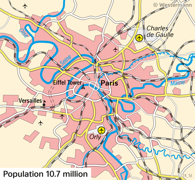
Around 2020
After the world wars, Paris gradually developed into an agglomeration with around 12.5 million inhabitants (Aire urbaine). An outer motorway ring, the "Boulevard Périphérique", was built around the inner Boulevard ring, which was completed in 1973 and borders the Ville-de-Paris department. Growth outside the Boulevard Périphérique was largely guided by the 1965 spatial development plan, which aimed to relocate industry to the outskirts to relieve pressure on the centre. To improve transport links, a number of new modes of transport were projected, including roads, railway lines and the Réseau Express Régional (R.E.R.) suburban railway network. Due to the projected population growth, five multifunctional towns were built around the Boulevard Périphérique (Cergy-Pontoise, Saint-Quentin-en-Yvelines, Marne-la-Vallée, Évry, and Sénart), which grew into a coherent urban settlement area with the centre in the following decades.
A large-scale bypass of Paris for long-distance traffic is hardly possible. All motorways and trunk roads lead to the edge of the city centre, causing major traffic problems at certain times of the day. The major international airports Roissy-Charles de Gaulle and Orly are also comparatively close to the city centre. Paris occupies a central position in the high-speed network of the French railways (TGV).